Strike me down

Today I join the ranks of striking university staff*. I thought it was worth taking a few minutes to explain why.

Toward the end of last year the University Superannuation Scheme (USS), which provides pensions for some 200,000 university staff (including lecturers, administrative and support staff) published its most recent valuation of its assets and forecast expenditure. They started off by taking a low valuation of their assets, then crunched some numbers. The outcome of this was that there appeared to be a a 40-ish% risk of the pension pot defaulting.

The employers who pay into USS instructed USS to move to a ‘low risk’ forecast, where investments were moved to lower interest but lower risk securities. USS re-did the numbers and suddenly the risk of default becomes 43%. Much shaking of heads. Pensions must be cut!

There’s a really nice breakdown of why this is all wrong here. But the long and short of it is that this forecast is based on the assumption that pretty much every University established before 1992 (i.e. the overwhelming majority of USS employers) goes bust at once. That every employee from those universities does not take part in the Higher Education economy any more, and that they cease paying into the USS scheme. In other words, this forecast is built on the assumption that pretty much the entire sector collapses. Now, while I’m certainly not optimistic for a post-Brexit UK economy, even I find that ridiculous.

support-our-strike-to-defend-uss_pfbcoverThis whole approach to number crunching is based on the fact pension funds must be evaluated by ‘managing the risk of default’. While appropriate for individual businesses and employers, trying to patch that onto a sector-wide pension scheme is obviously not particularly appropriate. Not to mention the fact that any collapse of that magnitude would lead to such extreme impacts on the economy that any forecasts made now would be meaningless in any case. It is equivalent to a buildings insurance policy assuming that all houses in the country are going to be destroyed by a volcano in the next 12 months, and therefore that any premium less than £200,000 will result in default of the insurance company.

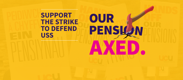
The USS response to this farcical forecast was cuts to pensions that will result in up to 40% reductions in payments. This is on top of changes that were made several years ago to solve the perceived pension shortage in a forward thinking manner; retirement ages were hoisted up, final salary pension schemes were axed, the usual. All of this against a backdrop of a university sector so buoyant that university heads are giving themselves pay rises. The financial situation in Universities UK and the USS is just not even remotely comparable to other pension cuts seen in recent years.

And perhaps even more importantly, all of this appears to have been triggered by a survey of USS employers, which has overly weighted the influence of universities with colleges (each college counts as a separate employer), and for whom at least some of their responses were drafted by individual staff members without consultation.

TLDR: Bad numbers, leading to bad assessments, fed by bad surveying, leading to bad decisions, leading to the screwing over of nearly a quarter of a million people.


* There’s several reasons I haven’t taken part up to this point which I might go into in another post, and am happy to elaborate on in the comments.

PS – Yes, we’re just going to gloss over the fact I haven’t posted anything here for 4 years.


Posted in General, News | 3 Comments

This is the point.

Yesterday the European Space Agency successfully landed the Philae lander on comet 67P. Anyone can appreciate that it’s an astonishing technical achievement, but a recurring theme I have noticed on various news article comments and discussion boards is that there’s a significant proportion of the population who just don’t see the point. “What a waste of time and effort”, “that money could have been used better elsewhere”, and a host of similar criticisms.

This kind of response is, sadly, rather common in a number of areas (similar comments can be found relating to almost any scientific endeavour that is not directly applied science; the LHC, animal behavioural studies, the whole of astronomy, and so on). In fact, it sometimes feels like it applies to any scientific achievement which isn’t directly contributing to either curing cancer or the development of hoverboards.

It’s part of a wider issue too. This all relates directly to the diminishing value placed on pure vs applied research. Some politicians seem to be devaluing science to the point that if a 3 year research project does not produce a commercially viable discovery at the end, it’s not science worth funding.  Grant application forms now routinely ask researchers to state what they’re going to find. Just think about that for a moment.  While there is certainly merit in having a coherent plan in much of research, we are also missing opportunities to just see what this thing does.

Blue skies research is vital, but neither politics or journalism work on the same timescales as science, which leads to a significant disconnect with the public and policy makers. The idea of investing in research now which may not see application for decades is anathema to many.  It doesn’t fit with the money-in results-out sausage factory that people often want or expect.

The Rosetta mission, and Philae lander in particular are a case in point. A probe that was launched 10 years ago, lands on an isolated comet in the middle of nowhere, and all people see at this point is that there’s some kerfuffle in the news, and a picture of a rocky ice-cube. They see the cost in launching the mission, and they see a single photograph as a result. They do not consider the impact of the science mission here on future research. They don’t even necessarily understand that this event marks the start of the scientific mission, not the completion. They ignore the technological developments in launching a mission like this, and how engineering solutions from missions like these feed their way back into normal life. They do not necessarily appreciate the enormous potential for this mission to feed into our understanding of our solar system, its formation, and the planet we depend on for our survival.

Artists impression of the Philae lander on touchdown. Courtesy of ESA.

Artists impression of the Philae lander on touchdown. Courtesy of ESA.

The argument that really gets me is when people complain about the wasted money. These complaints suggest that projects take the cash value and somehow ‘use up’ all the money, for it never to be seen again. This naïve economic assessment ignores the entire process of spending. This money doesn’t get incinerated on the Bunsen burner of science; it gets paid as salaries, and spent on equipment and services. It gets spread around to a huge range of high-tech and support industries which are essential to cutting-edge research – precisely the kind of industries that governments are desperate to encourage. The kind of employers that parents hope their children will get to work for. The kind of companies that encourage education and investment in people. And then there’s the support and administration staff that every research department and hi-tech firm relies on.

The salaries paid to all of these people get spent on food and bills and clothes and all the usual trapping of life. That grant money also draws in more external investment. In short, the money spent on science research not only gets pumped straight back into the economy; it boosts the economy, and even has the potential to unlock new discoveries and new engineering solutions, which lead to new products, and maybe – just maybe – the technology to make a working hoverboard.

That’s not to say that applied research is somehow the poor cousin to the more blue-sky projects – it’s not. But it is essential that we push the boundaries wherever we can see them. The man or woman who invented the wheel did not envisage trains or motorbikes, but their experiments with roundness and diameters laid essential groundwork. All of science builds on the foundations of what has gone before, but blue sky research forms the scaffolding and framework around which towers can be constructed.

So please, next time you see someone making the ‘applied research is the only necessary research’ argument, point out that they are suggesting the equivalent of navigating through a mountain range by only looking at the step in front of you.

Posted in Astronomy, General, Geology, News, Science | Tagged , , , , , , | Leave a comment

Bárðarbunga fissure eruption

Well, the very impressive dyke intrusion which has been steadily growing over the last week or so appears to have broken the surface. A 1 km long fissure eruption started early this morning and is ongoing – see this webcam for a good aerial view (although it seems to be getting hit pretty hard with traffic, so the connection can be a bit flaky). EDIT: There’s a second webcam here, which is behaving better, and you can just see the eruption in the distance. The image below is a screencapture with the fissure eruption circled.

Fissure eruption in the distance (circled). Screencapture from the Mila webcam: http://www.livefromiceland.is/webcams/bardarbunga

Fissure eruption in the distance (circled). Screencapture from the Mila webcam: http://www.livefromiceland.is/webcams/bardarbunga

A fissure eruption is exactly what it sounds like – an event where eruptive material exits along a linear fissure. Iceland is particularly well known for fissure eruptions, although they can occur anywhere you have dykes being injected; these subterranean magma sheets are what feed these linear features at the surface. They are particularly common in extensional tectonic settings, such as Iceland, which of course sits on top of the North Atlantic spreading axis.

The eruption so far seems to be pretty low energy and output, with steam and tephra being fountained just a few hundred meters into the air (my own estimate from the webcam images). This might be a function of the magma cooling rather rapidly as it progresses through the dyke, resulting in a somewhat more viscous melt, which generates a tephra-rich eruption rather than the effusive fire-fountaining more typical of these types of event. For more information on the magma being erupted, have a look at this contribution from Christina Manning, an expert in Icelandic geochemistry, who specialises on these volcanoes.

EDIT 11am 28/8/14: There’s some great aerial footage, from a light aircraft flying along the length of the fissure here: http://www.ruv.is/frett/fyrstu-flugmyndir-af-eldgosinu. You can clearly see the spatter ramparts that have been built up by the early stages of the eruption, now only venting gases.

Posted in Uncategorized | Tagged , , | Leave a comment

The Bárðarbunga dyke intrusion

So my previous post on Bárðarbunga focussed on the geochemistry and plumbing of the volcano, but I thought it might be useful to talk a little bit about the activity we’ve witnessed over the last week or so.  While the emphasis is always seemingly on the potential eruption of magma (and while there was evidence of a subglacial eruption on the 23rd, it was subsequently discounted), I think by far the more interesting story is what’s going on underground.

The area has experienced a huge number of earthquakes, as high pressure magma has injected its way into the rock around the volcano. Most significantly of all, by observing the focii of these earthquakes (i.e. their precise spatial location), it has been possible to trace the formation of a dyke. Conceptually speaking, a dyke is really quite a simple feature – it’s a sheet-like intrusion of material which cuts it’s way through the surrounding rock with little regard for existing bedding or structures. They are phenomenally common in most igneous settings, and can range on a wide variety of scales. The smallest can be just a few centimetres thick, and perhaps only meters long, while the largest can be tens of kilometres in length and tens of meters in thickness. The image below is of a roadcut through some (subhorizontal) igneous strata* which are cut through by a ~4m wide dyke in the Teno Massif, Tenerife.

Dyke cutting through mafic cumulate lavas, Teno Massif, Tenerife.

Dyke cutting through mafic cumulate lavas, Teno Massif, Tenerife.

The data up to the 20th August give you some idea of the early propagation of the dyke system (see the video here), but the most recent data from the Icelandic Met Office is breathtakingly lovely. These charts demonstrate a really clear dyke system, propagating toward the North East, at a rate approaching 5km a day.

It might just be because when I did my undergraduate mapping on the Isle of Skye many moons ago I ended up spending weeks measuring the orientation and sizes of literally hundreds of individual dykes, but I find these things fascinating. Looking at these features up close, you get a real feel for the amount of energy required to form them. As well as the huge volumes (and masses) of material involved (and lets not forget every cubic meter of magma has a mass somewhere in the 2.5-5.5 metric tons range), the host rock around the dyke experiences contact metamorphism from the intense heat being introduced. Often when you look at dykes you can observe complex internal variations and flow banding, as separate pulses of material are fed into the fracture. You can see the evidence of a dynamic plumbing system, responding to changes in magma supply and plumbing happening maybe tens of kilometers from where you are.

The dyke being intruded below Vatnajokull is growing at an impressive rate – calculations on the 26th August placed magma emplacement in the region of 50,000,000 cubic meters  in 24 hours – for comparison that’s about as much oil as gets shipped by oil tanker, globally, in 2 months.  This is a phenomenal bit of observational geology that we’re getting to witness, giving us a real insight into the timescales and behaviours related to the formation of these relatively simple features. Now, excuse me while I grab the popcorn and watch the show.

*These particular strata are somewhat weird.  They have incredibly course grainsizes, but form in very thin (cm) thick ‘beds’. They are often inferred to be the deposit left by lavas with very high crystal loads, in which the large phenocrysts settled out while the more mobile fluid moved on, forming more classic lava deposits further downslope.

Posted in Earthquakes, Geology, News, Science, Volcanism | Tagged , , , , , | 2 Comments

Bárðarbunga – Plumbing the depths

The internet has lit up in the last three days or so with people getting (over?)excited about activity at the volcano of Bárðarbunga in Iceland, particularly since the Icelandic Meteorological Office have been gradually ramping up the Aviation Colour Code from green (“normal, non eruptive”) through yellow, to orange (“heightened unrest, increased likelihood of eruption / eruption underway with no/minor ash”).  Situated beneath the Vatnajökull glacier in the South East of the island, it’s yet another hazardous volcano that people didn’t even know was there to be worried about. As a result, there seems to have been a lot of scrabbling about and information gathering going on by all the media outlets, matched only in its haste by the appearance of click-baity rubbish bearing such informative titles as “Livestream a Gigantic Volcanic Eruption”. The edit history on wikipedia is itself a sight to behold.

The volcano is notable for producing the largest known lava flow on the planet for the last 2 million years or so, with a volume somewhere between 21 and 30 cubic kilometres. This, however, is atypical behaviour; with smaller scale activity being relatively common. Indeed, that list suggests there may have been activity as recently as 2008. The issue being that the presence of the large glacier overhead precludes direct observation, so the only chance of confirming eruption is if it is significant enough to burn its way through the ice cap to give us a tephra layer. The more recent activity is inferred purely from seismic monitoring, similar to what was done with the monitoring much of the submarine El Hierro eruption a few years ago. The other intersting feature of volcanoes located under icecaps is the associated flood risk when that water gets melted – the Icelandic Road and Coastal Administration just released this traffic prohibition over an area of several hundred square kilometers due to flood risk.

Anyway, the Global Volcanism Program has a pretty comprehensive description of the volcano, with related bulletins, photos and background, so I won’t sit here repeating what you can get elsewhere. There’s also an excellent breakdown of the seismic activity here, showing a really beautiful migration of the seismic source through time. Below is a video demonstrating the 3D distribution of quakes in the last few days.

I thought I might try and add to the proceedings by speaking to someone with some expertise on the subject; Dr Christina Manning, a geochemist at Royal Holloway, University of London who has been working on Icelandic volcanism for the last 10 years or so, and is particularly interested in variations in the mantle below Iceland, and what the products of the different volcanoes can tell us about the structure of this very complex and highly productive system. I caught up with her today to get the low down on some of the more subterranean aspects of this interesting case study.

Screencapture of activity at Vatnajokull, showing seismic even location and magnitude with time. http://en.vedur.is/earthquakes-and-volcanism/earthquakes/vatnajokull/

Screencapture of activity at Vatnajokull, showing seismic even location and magnitude with time. http://en.vedur.is/earthquakes-and-volcanism/earthquakes/vatnajokull/

So, over to Christina…

What’s the definitive pronounciation?

the ð in Icelandic is a hard th sound which I think is pretty much only pronounceable by Icelandics (bit like the french rolling R) so it should be pronounced Barth a bunga

What type of volcano is Bárðarbunga? What’s the magma like?

The Bárdarbunga- Veidovotn volcanic system is 190 km long and up to 28 km wide, covering about 2500 km2 which makes it Iceland’s most extensive volcanic system and the second most historically active  (Thordarson and Larsen 2007). Bárðarbunga is the central stratovolcano of this system.  In contrast to what may be expected from magmas erupted at a stratovolcano, analysis of tephra glasses from historic Bardabunga eruptions show the lavas to be predominantly basaltic in composition.  Volcano-ice interactions are a significant influence on the formation of Icelandic stratovolcanoes, giving rise to alternating lava flows and volcaniclastic deposits which generate the steeper flanks than observed on subaerial Icelandic central volcanoes which tend to be flatter shield volcanoes.

What type of eruption might we expect?

The subglacial situation of the Bardabunga volcano means that despite its relatively basaltic composition interaction with ice has the potential to erupt explosively.  This could give rise to an ash plume as observed during the Eyjafjallajokull eruption.  But depending on where the vent opens it could initiate a fissure eruption similar to that seen at Grimsvotn which would be less explosive and more effusive, generating fire fountains and lava flows.

How does Bárðarbunga relate to the likes of Eyjafjal, Grimsvotn and Katla? Do they share any plumbing?

The lavas at Bardarbunga appear to be less evolved than those observed at Katla and Ejafjall but there is probably a sampling bias here due to the limited access to material at Bardarbunga which means that analyses are constrained to tephra.  This means that the risk of a very large eruption as speculated for Katla is significantly reduced.  The activity at Bardarbunga is more likely to be similar to that of Grimsvotn given their similar locations relative to the areas of active rifting and the similar lava chemistry.  There is no geochemical evidence for shared magma plumbing between the Bardabunga-Veidvotn system and Eyjafjall or Katla.  There is evidence of interaction with magmas from the rhyolitic centre of Torfajokull within the Veidvotn lavas which suggests some shared plumbing.  Whilst there doesn’t appear to be any link between activity along the Veidvotn fissure and that at Torfajokull there is always a risk of triggering eruptions in linked systems by magma movement and depressurisation.

Is there anything unusual about this activity?

Not really given the geodynamic situation of this area of Iceland.  We are essentially looking at the subaerial version of a mid ocean ridge so regular volcanic activity is to be expected along the spreading ridges.  Put on top of that the presence of a mantle plume centred beneath the Vatnajokull glacier and the amount of volcanic activity in this region seems relatively minor given how favourable the geodynamic conditions are for melt production and transport to the surface.

Where does geochemistry come in to all of this?

Being a volcano/geochemistry enthusiast means that i take great joy in working out what goes on beneath areas of volcanic activity from the mantle up, but as someone who works on predominantly older deposits it is sometimes difficult to persuade people that what you are doing is important.  Then a volcano gets a bit rumbly and suddenly people want to know what its connected to? what are the implications of magma movement along a certain system on the risk of eruption at other centres?  And that is when geochemistry of both old and young samples can be particularly enlightening.


Posted in Earthquakes, Geochemistry, Geology, Geophysics, Hazard Assessment, Volcanism | Tagged , , , , , , , , | 2 Comments

The avoidance of negativity

It has been a criminally long time since I posted. It’s not that I’ve had nothing to say in that time, and I’ve certainly had the time on my hands to have made a post. However, there’s a very good reason I didn’t.

Having spent 2012-13 in France working at the Laboratoire Magmas et Volcans (an outstanding experience I would heartily recommend if you get the chance), I found myself heading back to the UK with a couple of job opportunities lined up. The first month or so was hectic beyond belief as I dealt with paperwork, but then everything went quiet. Sadly, the job I had hoped for got pulled out from under my feet at the last minute due to a budget shuffle, and I then entered the black hole of frustration that is “being a postdoc looking for a job”.

And what I can state in no uncertain terms is that there’s a dearth of jobs in my field with a large number of applicants. I can’t count the number of times in the last months when I’ve found myself doubting my abilities, my skills, and my prospects. And that is why I haven’t posted; a kind of strict approach to not filling this blog with negativity, and not voicing the opinions of the devil on my shoulder. It’s not quite imposter syndrome, but it’s definitely a low-level frustration that I have done my best to just ride the wave of.

I’ve been told by industry recruiters that they would rather employ a freshly completed PhD rather than someone who has a brace of postdocs under their belt and is therefore ‘indoctrinated into academia’. And the lack of suitable positions within academia over the last months has lead to me competing against candidates who were altogether more qualified and suited for the particular niches in the institutions I was trying to squeeze myself into.

I’ve been filling my time with a number of activities – getting married being the main one, and having organised and equipped the whole thing almost completely ourselves I was certainly able to make the most of my ‘free time’. I’ve also been working as a freelance tutor for a number of local schools and organisations – really rewarding work, helping great kids improve their science. It’s work I enjoy, but it’s not what I’m trained for and dreaming of. It is at least paying the rent.

This post isn’t to say that I’ve found a job – nothing yet, although I have several very exciting irons in fires. It’s more to get this out of the way so I can concentrate again on creating  good content for this site and moving on.

It’s also to just provide a voice for the others I know who are in the same boat out there; of the postdocs I have worked with in recent years, everyone has had a tough time making the break either into more permanent roles or breaking out of academia altogether – they’re not the only ones (although we all seem terrified of telling anyone that we’re having a hard time, like it’s a failure on our part in this hugely over-saturated market).

So, to be clear; I’m still alive, I’m still on the job hunt, I’m still open minded about where that will take me, and I promise it won’t be 2015 before my next post.

EDIT – Job hunt complete. If you’re still looking, keep at it. I completely sympathise with how crap the whole process is.

Posted in General | Leave a comment

Turbidity currents, pretty pictures, and an amazing 3D imaging tool

As well as my work on pyroclastic modelling, my first postdoc was spent investigating submarine turbidity currents. It’s fair to say most of the general population have never heard of the things, which might be considered bizarre considering the fact that a single one of these flows can transport more sediment than the all the worlds rivers put together manage in a year.  To put that into numbers, rivers are estimated to throw out something like 13-15 billion tons. That equates to around 5 x 10^12 L, or 5 cubic km of sediment. For scale, that’s about 5 times the amount of material that Mt St Helens threw out in 1980. However, even a small turbidity current will deposit volumes of 10 cubic kilometers. 100 cubic kilometers is relatively common. There are big ones which have been known to move as much as 3,500 cubic km. (Sidenote, the deposit of a submarine turbidity current is called a turbidite).

How do we know this?  Geology. And interestingly, almost only geology. We can observe the deposits of these flows, but no-one has ever seen one in action. We have not a single measurement from within one of these deep-basin flows. We have some measurements of small scale flows occurring in shallow water which we believe behave in a similar way to the deep basin stuff, but even these experiments have never measured the concentration in the important dense part of the flow. Our only other line of evidence is one which raises the importance of understanding these things; in 1929 an Earthquake triggered a turbidity current on the Grand Banks. That current severed a dozen subsea communications cables, but we can at least use those data to estimate speeds of that current. Turbidity currents have caused plenty of other subsea damage in more recent history as well. With almost all of our international communications traffic delivered by subsea infrastructure, these things have huge potential for damage.

Some months ago I was invited to attend a workshop being held in Italy to address where turbidity current research is, and what future work might focus on. This was being organised by Pete Talling at the National Oceanography Centre in Southampton, who recently put out an excellent review article on the subject. I of course accepted, and a fortnight ago found myself in Bologna trying to look for a ‘brown haired Italian man’ who was going to pick me up.

The workshop was excellent, with 32 attendees from across the world and specialisms. We spent about half the time in discussions, and the other half in the field (still having discussions). I won’t go into too much detail on the work presented as I know a lot of it is still heading for publication, but suffice to say we had a fantastic mixture of modellers, sedimentologists, industry guys (turbidites can form major petroleum reservoirs), and experimentalists. It’s the first workshop I’ve been able to attend, and it blew the socks off every conference I’ve ever been to for enabling dialogue between people, and it was useful dialogue.

There were some awesome presentations from the guys at MBARI and the Canadian Geological Survey looking at flow observations around Monterey Bay, the Fraser Delta and the Black Sea. Some really interesting modelling from Andy Hogg at Bristol demonstrating how important modelling a variety of grainsizes is in getting deposits correct. There were also plenty of presentations on how we model and observe complex 3D architectures from a variety of perspectives.

The fieldwork was focussed on looking at a turbidite sequence in the Apennines, which formed as a pretty much perfect layer-cake of horizontal beds. Did I mention that turbidity currents have no problem propagating for hundreds of kilometres along slopes shallower than that on a  football field?

IMG_1583So what you see in the field are alternating layers of sand (the turbidite) and mud (some of it settling out after the sand deposits, some of it then settling out of the water column as normal hemipelagic mud over the hundreds or thousands of years between flows). Interestingly, you can tell the difference between the turbidite mud and the hemipelagic mud from the colour contrast; The mud deposited by the turbidite is a slightly bluer colour than the paler hemipelagic mud. This photo shows a layer of turbidite mud at the bottom, then a pale hemipelagic mud above that, finally capped by the next turbidite sand, with mud again on top of that.

IMG_1595

The really nice thing about turbidite sequences is that while you get the really clear differential weathering between the hard sand and the softer mud highlighting the broad structure, there is so much amazing fine structure to observe as well. Take, for example, mm-scale horizontal laminations:

IMG_1624And convoluted bedding formed by remobilisation of wet sediment

IMG_1648

And my personal favourite, dewatering features. Favourite because they are really difficult to see unless the sun is just right.

IMG_1640Those dewatering features also seem to be associated with really subtle surface ridges. I got into a very interesting and ultimately inconclusive debate with Esther Sumner and Frank Peel about how you could form these uniform ridges (which appear to be strongly correlated with the original flow direction).

IMG_1646One of the best discoveries of the week, however, was a little something Mike Clare from Fugro introduced me to. Geological community – may I introduce 123D Catch. In summary, take a few dozen photos at different angles around an object, and this free bit of software automatically works out where each is in relation to the other and builds a 3D model, which it then textures and allows you to manipulate as a 3D object.

I’m still very new to it, and the two samples I tried in Italy have not come out brilliantly. however, I present to you the dewatering features in glorious 3D:

A little shonky with a few model gaps because I didn’t take enough pictures. There’s another one of convolutions that I’ll upload for another post, probably describing the app in a bit more detail.

Get to it geofiends – I think this has some real potential.

Posted in General, Geology, Science, Sedimentology, Travel | Tagged , , , , , , | Leave a comment

#IAVCEI2013 wrap-up & photos

The conference is done, the return flight completed, and the bag of laundry dealt with.

The general consensus amongst those I spoke with after the conference (and a view I agree with) was that it certainly ranks up there with the memorable ones.  There was some excellent science presented, and the city of Kagoshima made a great venue. That was all topped off with some spectacular activity from Sakurajima, and a couple of impressive events put on by the organising committee.

My particular favourites with the science I think go to:

1) Ben Andrews, who presented some really lovely work looking at dilute pyroclastic density currents (PDCs), and some work from his most recent experiments using a laser array to observe the turbulent cloud dynamics.

2) Anne Mangeney, presenting work on PDC erosion, which is desperately understudied at the moment.

3) Robin Matoza, who highlighted that some of the physics being used to monitor eruption jet acoustics is 40 years out of date with regard to the present understanding used in the aerospace industry.

It would be remiss of me not to wax a little more lyrical about the behaviour of Sakurajima while we were there; with an average of 6 eruptions per day we were treated to a lot of picturesque photo opportunities…

This was the view on the first night from Kagoshima harbour

IMG_0959And the second night from the island itself as the sun went down

IMG_0997

On Monday a series of mid-conference field trips were run, and the one I was on spent a couple of hours in the morning at Sakurajima, before heading up to Kirishima later in the day. This was Sakurajima about 2km  from the vent when it was kind enough to spend an hour or so throwing intermittent pulses up for us.

IMG_1194

Of course, what we didn’t expect was what we saw in the mid-afternoon, just as we were returning to Kagoshima…

IMG_1293

The luck of the draw meant that we were just the wrong side of a hill and stuck on a coach. We also knew that then other group were almost certainly at the lookout point the previous photo was taken from.  we eventually got the coach driver to stop after about 10 minutes to see the plume drifting away, having reached a final height of about 3200 m.

IMG_1298-Edit

Still trying to get hold of some photos from colleagues on the other trip, and still phenomenally jealous that they got such a good view (including co-eruption lightning within the plume). EDIT – there’s a couple of lovely links in the comments.

The conference was rounded off with an amazing dinner, although made somewhat weird by the rapid ushering-out we received once the meal was over and the coaches were all ready to leave. That in turn was followed by a visit to several bars in Kagoshima, including a tiny reggae bar jammed full with about 200 volcanologists, including 3 or 4 behind the bar helping to serve.

If you’re at all interested, I’ve uploaded my poster presentation here, although the oral will stay offline for the moment as it doesn’t make a lot of sense without a lot of commentary.

I’ll leave you with a final few shots I took on the morning before my flight back, while visiting the Kagoshima aquarium. well worth a visit.

IMG_1460 IMG_1452 IMG_1400 IMG_1437

Posted in Geology, Hazard Assessment, News, Science, Sedimentology, Volcanism | Tagged , , , , , , , , | 4 Comments

#IAVCEI2013 – The second best volcanology conference in Kagoshima

It may come as no surprise that Kagoshima – home to the most active volcano in one of the most volcanically active countries in the world – has played host to more than this years IAVCEI meeting when it comes to getting volcanologists into town. You might guess from the spectacular way in which they play host; notices, flags and IAVCEI branded fans and accessories adorn much of the town. The conference goody bag bears not just the usual USB stick, local promotional material and a notebook, but full geological maps and hazard maps of Sakurajima and a variety of other volcanoes in Japan. In fact, one outstanding full map showing Japan in its complete volcanological beauty. Oh, and a 3D plastic map of Sakurajima. And tickets to a festival of music and fireworks. And an invitation to go and watch the ’round volcano yacht race’ and complimentary tour cruise.

The reason I feel IAVCEI may be playing second fiddle to another conference is that both these events – the festival and boat race – are held to commemorate the 1988 Kagoshima International Conference on Volcanoes. I’ve never heard of an event being staged to commemorate the anniversary of a conference before, let alone two. It must have been one hell of a conference. My mind can’t decide whether it should be picturing volcanological luminaries dangling from light fittings, dripping sake from their over-gorged throats, or some kind of terrible boating disaster with fireworks.

Anyway, this evening was the festival, so I took the opportunity to skip out of the conference early (5.30 start time for the event was not handy for the 6.30 finish of seminars – fortunately nothing took my fancy this afternoon anyway). Grabbed the complimentary ferry across to Sakurajima, and went and sat in a field. I will say this for the Japanese – they do events in a unique and special way. After finding a spot that was just about in the shade, and occasionally catching the dregs of a breeze to take the edge off the 34 degree heat, I sat down, and relaxed. Camera in hand, I was determined to get a good sunset shot of Sakurajima if nothing else. She did not disappoint, and photo will be forthcoming just as soon as I have a USB cable.

However, it would be doing the festival a disservice if I didn’t recount some of my favourite moments here. Billed as offering a Hinoshima drum performance, I was looking forward to some tubthumping music. The “6000 vigorous fireworks” also sounded appealing. The build up to these, however, was sublime. First up, we had some kind of stage play featuring what I can only describe as a guy dressed as a Power Ranger, another as a teddy bear, and a couple of guys dressed in form-fitting white lycra bodysuits having sword fights. Not knowing the language I was free to make up my own story in my head, and completely failed to come up with anything coherent. So I assume it was an actual episode of Power Rangers.

Next up, we had the local choir doing their thing. Very choral, but the crowd weren’t interested. After that we had a couple of ladies doing a fan dance, followed by another dance troupe with ribbons or scarves (I was too far away to tell). After that we had a rather bizarre karate act who sang. She would do a few karate moves, sing a song, then smash a bit of wood, another song, smash a brick, etc. With no clear idea of what was going on I decided it was some kind of superhero or videogame character, and she could only do 30 seconds of karate after a 2 minute power-up period of singing.

Next up the drums, which were excellent. However, at this point I was aware that last up were the fireworks, then there were going to be about 10,000 people or more crowding back to the ferries, so I wound my way back down the hill to try and catch the firework display from the water, with Sakurajima in the background. On my way back I took the opportunity to grab some dinner. Japanese festivals it turns out have an impressive array of Things On Sticks. Sweet things on sticks, savoury things on sticks, miscellaneous things on sticks. I treated myself to the squid-on-a-stick, although opted for the body portion rather than the Lovecraftian tentacles-on-a-stick.

And here we are back in the hotel, 9.30 pm, aiming to kill the last of the jet lag in the hope I don’t fall asleep tomorrow, particularly as I’m presenting. 3pm session in A4 for anyone here.

Some great science today – some lovely experiments looking at magma chamber dynamics, and gas-slug growth through conduits. I love me a good experiment, and Ed Llewellin and others at Durham have a 13 m monster conduit they’ve produced some fascinating results in. Also some really interesting work on the effects of melting the roof of magma chambers, although with so few variables investigated it felt a bit like a spherical cow at the moment – clearly more work to be done.

Right – off to wash the volcanic ash from my grubby feet, and rest my weary head. More updates to follow.

Posted in Geology, News, Science, Travel, Volcanism | Leave a comment

#IAVCEI2013 – The land of the rising sun

Japan is bloody hot and humid. Stepping off the plane was more like walking into a well-prepped sauna.

Just thought I’d get that out of the way.

After three flights, no sleep, and 3 hours in a park twiddling my thumbs before being able to check in to the hotel I’ve finally managed to have a shower, put on some clean clothes and get over here to internet land.  I just thought I would share with you some cool things and observations from the last day or so of travel.

Firstly, Charles De gaulle is a sprawling mess of an airport. I know this is hardly a controversial opinion, but I’ve flown through that place probably 2 dozen times in the last year and I just wanted to take this opportunity to express my loathing.

Secondly, the Paris-Tokyo flight route is fascinating for a number of reasons:

  • You get some great views over Holland and Scandinavia (pics to follow).
  • Your sense of scale also gets a life-changing smack around the face when you spend the best part of 9 hours flying over the completely unpopulated expanse of Northern Russia. I’ve flown over Canada before, but there’s always a few roads or settlements or whatever. There is a wild untamed beauty to the forests and tundra of Northern Russia that is really quite breathtaking.
  • During the summer, if you leave at about mid-day, you experience an interesting phenomenon; the sun never sets, which seems to somewhat steal Japan’s thunder, given what the name literally translates to (see title of post if you’re not sure). I had the sun coming in through my window for 10 of the 12 hours – the only reason I didn’t for the first two hours was that we were pointing in the wrong direction. It was my first experience of an arctic circle night, and it was quite bizarre – particularly as at both the departure and destination locations the sun was high in the sky and blazing a fierce heat.

Japan’s topography is amazing. As well as a great view over Mt Fuji (again, photos to follow once I have access to an appropriate USB cable), the terrain is utterly ‘ruffled’. Everywhere you look the land is carved up into inhabited and farmed floodplains along narrow river valleys (itself broken up into impossibly regular and bizarrely small field systems), fingering between wooded ridges and hills which Slartibartfast himself might have said were going a bit overboard with the detail work. Take this perfectly standard example:


The trip from Kagoshima Airport to the city centre was made vastly more enjoyable by the conversation with the young lady completely astounded that so many Westerners would want to all go to Kagoshima. Her parents run a hotel on nearby Yakoshima (a world heritage site), and she was going back for the weekend. On asking what she would recommend to do on any free days the best she could manage was ‘there’s probably some old buildings? Personally I would go shopping’. Then she recommended that I had to try the local speciality of ‘Black Pork’. She had no idea why it’s black but apparently it’s delicious.

Right, off to rest my weary head and make a vague attempt at avoiding jet lag. Last time I flew out in this direction for a conference was IUGG in Melbourne a couple of years ago. I went straight over to see a friend in Tasmania before the conference, had a lovely first day, then sabotaged the second by somehow falling asleep for 18 hours. For someone who normally lives on 6-7 hours a night it came as a bit of a surprise. Fingers crossed I can make it up in time to get a sunrise shot of Sakurajima out in the bay.

Posted in General, Geology, Travel, Volcanism | Tagged , | Leave a comment